


Benalla Rural City
Benalla Flood History
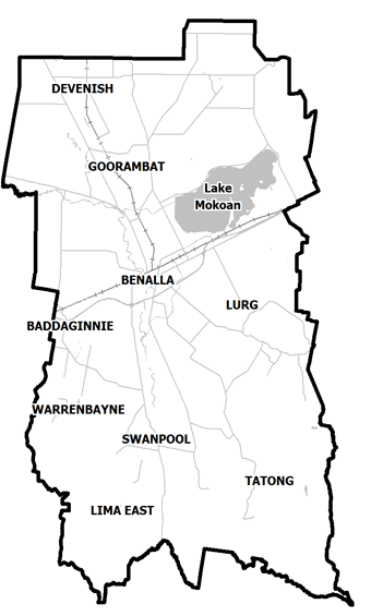
The Rural City of Benalla and its surrounds are at significant risk of flooding. Historically Benalla has been impacted by major flooding affecting businesses and residence. For example, in October of 1993:
-
1,500 people evacuated from their homes
-
500 houses and businesses flooded or cut-off
-
5 bridges damaged or destroyed, roads cut
-
400 km rural fencing & farm machinery damaged
-
Telephone services, power, sewage and water supplies damaged and interrupted
Benalla Local Flood Guide
Click the button below to view the Local Flood Guide, which includes information about the local flood risk and how you can prepare for and respond effectively to floods.
About Flood Guides
Communities can use local flood guides to identify and better understand their local flood risk. They include information about: flood history, how to prepare & respond to floods and who to contact.
Contact Information


Local SES Units
- Benalla VICSES Unit:
1 Samaria Road,
Benalla, Victoria.