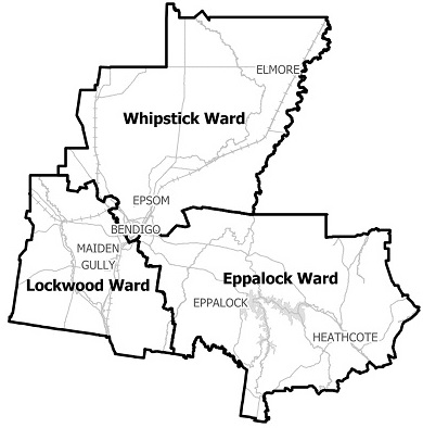
Flood information for the City of Greater Bendigo, encompassing local flood guides and a Municipal Flood Emergency Plan.
City of Greater Bendigo Flood History

City of Greater Bendigo has a long history of storm and flash flooding with varying impact, from small urban pockets to whole suburbs and outlying areas affected.
The lead time to respond to a storm and flash flooding events may be limited. All households and businesses at risk of flooding should develop an emergency plan and be aware of their flood risk.
The Golden Square and Kangaroo Flat area have a history of flooding and is especially prone to flash flooding with recorded floods occurring since settlement in 1850.
-
The 1857 flood is one of the largest on record and occurred after 82mm of rain fell in under 24 hours, causing significant flooding along the Bendigo and Back Creeks.
-
In November 1933 the Bendigo Creek overflowed its banks at Kangaroo Flat flooding 100 houses in High street and washing away a bridge in Alder Street.
-
In 1951, Bendigo received 80.2mm of rain over two days resulting in half a mile of railway line washed away. In Kangaroo Flat the water was waist deep.
-
In January 1996 heavy thunderstorms resulted in many shops and residences flooding throughout Kangaroo Flat
-
During March 2010 approximately 80mm was recorded in 3 days with a maximum burst of around 40mm in 2 hours
-
In September 2010 around 80mm of rain fell in 1 day with 40mm over approximately 10 hours
-
The February 2011 flood saw a total of 100mm of rain recorded over 3 days with approximately 50mm in a 5 hour burst.
Golden Square and Kangaroo Flat Local Flood Guide
Epsom, Huntly and Ascot Local Flood Guide
Bendigo, White Hills and Long Gully Local Flood Guide
About Flood Guides
Communities can use local flood guides to identify and better understand their local flood risk. They include information about: flood history, how to prepare & respond to floods and who to contact.
Contact Information
Local SES Units
- Bendigo VICSES Unit :
64 Adam Street,
Bendigo
Marong VICSES Unit :
35 Cathcart Street,
Marong
Heathcote VICSES Unit :
3-7 Wright Street,
Heathcote
Municipal Flood and Storm Plan
Municipalities can use Municipal Flood and Storm Plans to prepare, respond and recover from flood and storm events.
Greater Bendigo flood and storm Emergency Plan - Updated April, 2018
This municipal flood and storm plan is currently being updated. The revised and updated plan will be available soon.


