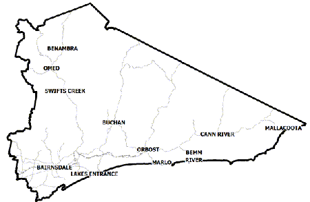
East Gippsland Flood History
East Gippsland is home to the Genoa, Cann, Bemm, Tambo, Nicholson, Snowy, Buchan and

Mitchell Rivers and the Gippsland Lakes. Weather systems commonly referred to as East Coast Lows can produce heavy rainfall on frequent occasions which can lead to minor riverine flooding with major flood events in both the rivers and lakes occurring more rarely.
For example, during June 2007, four major east coast lows occurred in succession with each one producing heavy rainfall. The last east coast low brought up to 300mm of rainfall resulting in major riverine flooding across the Council area and the Gippsland Lakes rising 1.3m above normal levels.
A significant risk is isolation of communities, vehicles and recreational visitors through the area when rivers and creeks rise, landslips and falling vegetation make roads impassable. Storms can also cause power and communication outages simultaneous to flooding.
Mossiface to Swan Reach Local Flood Guide
This guide is relevant for residents of
|
Click the button below to view the Local Flood Guide, which includes information about the local flood risk and how you can prepare for and respond effectively to floods.
Eagle Point Local Flood Guide
Lakes Entrance Local Flood Guide
Metung Local Flood Guide
Paynesville Local Flood Guide
Raymond Island Local Flood Guide
Lindenow, Woodglen, Hillside flood guide
Snowy River and Orbost flood guide
This guide is relevant for residents of
|
Click the button below to view the Local Flood Guide, which includes information about the local flood risk and how you can prepare for and respond effectively to floods.
Bairnsdale Local Flood Guide
Buchan Valley Local Flood Guide
This guide is relevant for residents of
|
Click the button below to view the Local Flood Guide, which includes information about the local flood risk and how you can prepare for and respond effectively to floods.
Genoa Valley Local Flood Guide
This guide is relevant for residents of
|
Click the button below to view the Local Flood Guide, which includes information about the local flood risk and how you can prepare for and respond effectively to floods.
About Flood Guides
Communities can use local flood guides to identify and better understand their local flood risk. They include information about: flood history, how to prepare & respond to floods and who to contact.
Contact Information
Local SES Units
- Bairnsdale VICSES Unit
Cnr Ligar and Macleod Streets, - Bairnsdale, Victoria 3875
- Bendoc VICSES Unit
9 Jamieson Street, - Bendoc, Victoria 3888
- Bruthen VICSES Unit
Main Street, - Bruthen, Victoria 3875
- Buchan VICSES Unit
Orbost Road, - Buchan, Victoria 3885
- Cann River VICSES Unit
- Monaro Highway,
- Cann River, Victoria 3890
-
Mallacoota VICSES Unit
Lees Road, PO Box 493,
Mallacoota, Victoria 3892 - Orbost VICSES Unit
5 Wolseley Street, - Orbost, Victoria 3888
- Tambo Valley VICSES Unit
Omeo Highway, - Swifts Creek, Victoria 3896
Municipal Flood and Storm Plan
East Gippsland Municipal Flood Emergency Plan - Gippsland Lakes (Updated May 2013)


