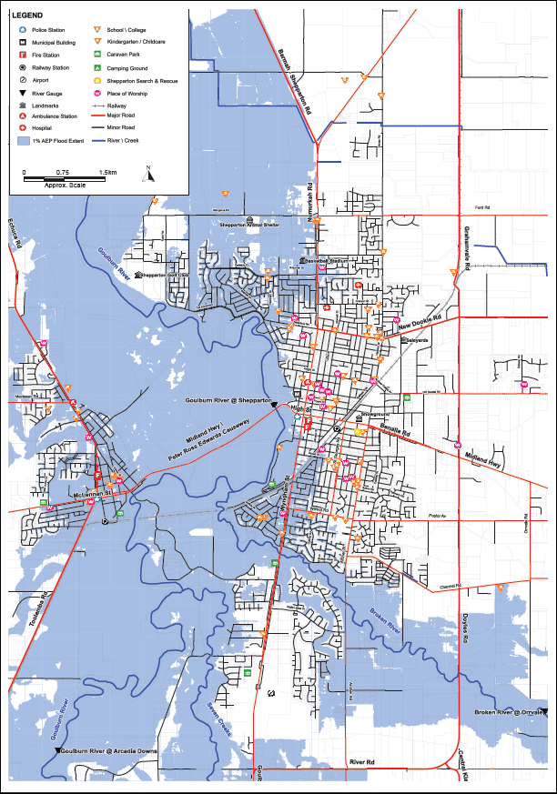
Flood information for the Greater Shepparton City Council, encompassing local flood guides and a Municipal Flood Emergency Plan.
Greater Shepparton City Council Flood History

The Greater Shepparton City Council has a history of flooding including in 1870, 1916, 1974, 1993 and more recently in 2010:
-
1974 was a Goulburn River dominant flood
-
1993 was a Broken River dominant flood
-
2010 was a flood which saw gauges on the Goulburn, Broken and Seven Creeks peak at major level.
During this flood, 13 houses and 31 buildings were flooded, 620 houses were isolated and more than 60 people attended the relief and recovery centre.
Floods like this or worse could occur again. Even if your property is not affected by floodwater, you may be impacted indirectly by road closures, isolation and disruption to essential services including telephones, power and sewerage. Flooding from the rivers in this area usually lasts about four to seven days depending on the rainfall. Roads and properties can also flood due to water backing up in the stormwater drain system.
Flash flooding caused by heavy rainfall can also occur in low-lying areas, especially in the industrial and business areas of Mooroopna and Shepparton East and around the Doyle’s Road- Midland Highway roundabout. These flash floods only last a few hours but can be dangerous and cause extensive damage.
Congupna Local Flood Guide
Katandra West Local Flood Guide
Shepparton, Mooroopna and Kialla Local Flood Guide
Murchison Local Flood Guide
Tallygaroopna Local Flood Guide
About Flood Guides
Communities can use local flood guides to identify and better understand their local flood risk. They include information about: flood history, how to prepare & respond to floods and who to contact.
Contact Information
Local SES Units
- Tatura VICSES Unit:
Martin St & Russell St,
Tatura.
Municipal Flood and Storm Plan
Shepparton City Council Flood and Emergency Plan - Updated July, 2023.


