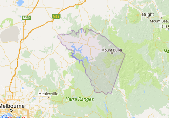
Flood information for the Mansfield Shire Council, encompassing local flood guides and a Municipal Flood Emergency Plan.
Mansfield Flood History

Mansfield Shire sits in the upper Goulburn catchment, which collects rainfall from Woods Point to Mount Skene and the western end of the Alpine National Park.
Mansfield Shire can experience both riverine and flash flooding. Riverine flooding typically occurs when the Goulburn or Jamieson Rivers (or both) break their banks and overflow after heavy or prolonged rainfall in the steep catchments of the surrounding state forests and Alpine National Park.
Flash flooding can occur at any time of year during and after heavy rain or thunderstorms. The hilly terrain makes flash flooding more likely as water can gain both speed and power as it flows downhill.
Flash flooding in September 2010 caused the largest recorded flood in the Jamieson area with 27 properties and the Jamieson caravan park flooded. This flood peaked soon after midnight, dropping away early the following morning.
Jamieson Local Flood Guide
About Flood Guides
Communities can use local flood guides to identify and better understand their local flood risk. They include information about: flood history, how to prepare & respond to floods and who to contact.
Contact Information
Local SES Units
- Mansfield VICSES Unit:
Maroondah Highway,
Mansfield, 3722
Municipal Flood and Storm Plan
Municipalities can use Municipal Flood and Storm Plans to prepare, respond and recover from flood and storm events.
Mansfield Shire Council Flood Emergency Plan - (coming soon)


