


Flood information for the Southern Grampians Shire Council, encompassing local flood guides and the Municipal Flood and Emergency Plan.
Southern Grampians Shire Council Flood History
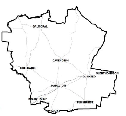
Southern Grampians Shire Council has a number of creeks, rivers and other waterways that are at risk of flooding, as well as a number of areas that are at risk of flash flooding from heavy rainfall occurring in a short period of time.
Historic flooding events include 1946, 1981, 1983, 2010 and 2011. The 1946 flood is still considered the largest in recorded history with many flood level records being broken during this event.
The flood event in 1983 is also a large flood for the area. During the floods, Hamilton, Coleraine, Branxholme and a large portion of the Wannon River from Henty to the shire boundary have been affected by flooding.
Hamilton Local Flood Guide
About Flood Guides
Communities can use local flood guides to identify and better understand their local flood risk. They include information about: flood history, how to prepare & respond to floods and who to contact.
Contact Information


Local SES Units
- Balmoral VICSES Unit:
31 Bell Street, - Balmoral, Victoria
- Hamilton VICSES Unit:
- 58-60 Shakespeare Street,
- Hamilton, Victoria
- Dunkeld VICSES Unit:
40 Templeton Street,
Dunkeld, Victoria
Municipal Flood and Storm Plan
The Southern Grampians Shire Council Municipal Flood Emergency Plan will be available soon.