Flood information for Yarriambiack Shire Council, encompassing local flood guides and a Municipal Flood Emergency Plan
Yarriambiack Shire Council Flood History

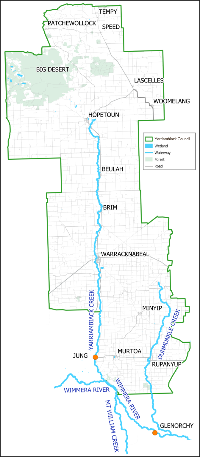
Click on the map to view the location map of Dunmunkle Creek, Yarriambiack Creek and Wimmera River in relation to towns impacted.
Yarriambiack Shire has a history of flooding, including the most significant recent flood event in 2011 which recorded widespread riverine and stormwater flooding throughout the Yarriambaick Shire region.
The highest number of buildings impacted by flooding was recorded in Rupanyup and Warracknabeal. Although minor flood impacts were felt in Brim, Beulah and Hopetoun, a significant number of houses were isolated during this event. As a result theree was widespread damage to roads, crops, stock losses and other community assets along Yarriambiack and Dunmunkle creeks.
There is significant lead time during riverine flood events, for Rupanyup 1 to 3 days and Warracknabeal 3 to 5 days after the Wimmera River stream gauge peaks at Glenorchy.
Towns such as Warracknabeal and Rupanyup are also heavily impacted by stormwater flooding, flooding from local rainfall. During January 2011 damage to a significant number of buildings was caused by stormwater flooding in these towns.
In Rupanyup over 149 mm fell over 3 days impacting the Rupanyup Café, and buildings in Cromie, Stewart, Edward, Gibson, Walter, Gordon and Beryl Streets. In Warracknabeal more than 151 mmm over 5 days impacting houses in Lyle Street, Gardiner Street, McIntyre Street, Asquith Reserve and the Borung Highway (east of the Racecourse).
| Jung stream gauge height (m) | Warracknabeal flood extent map links |
|---|---|
| 2.39 | |
| 2.3 | |
| 2.17 | |
| 1.2 | |
| 0.95 | |
| 0.84 |
Other Links
- Warracknabeal and Beulah Flood Investigation 2007
- Wimmera River & Yarriambiack Creek Flow Modelling Investigation 2009
- Warracknabeal and Brim Flood Investigation 2016 Flood Intelligence Report
- Warracknabeal and Brim Flood Investigation 2016 Flood Mitigation Options
- Warracknabeal and Brim Flood Investigation 2016 Flood Warning Assessment Report
- Warracknabeal and Brim Flood Investigation 2016 Proposed Levee Height Map
Warracknabeal Local Flood Guide
Rupanyup Local Flood Guide
About Flood Guides
Communities can use local flood guides to identify and better understand their local flood risk. They include information about: flood history, how to prepare & respond to floods and who to contact.
Contact Information
Local SES Units
-
Warracknabeal VICSES Unit:
19 Lyle Street,
Warracknabeal, VIC 3393 -
Dunmunkle VICSES Unit:
2 Wood Street,
Rupanyup, VIC 3388 -
Woomelang VICSES Unit:
6509 Berriwoolock-Woomelang Road, Woomelang, VIC 3485
Municipal Flood and Storm Plan
Yarriambiack Shire Council Flood Emergency Plan - Updated Feb, 2020.


